Pictured Rocks Lakeshore Trail Hiking, Backpacking, and Trail Running Guide

April 21st, 2026
Home > Where to Go > Backpacking Trips
The Pictured Rocks Lakeshore Trail (PRLT) is a 42.4 mile trail that aligns with the North Country Trail (NCT) as it traverses the entirety of the Pictured Rocks National Lakeshore, on the indigenous lands of the Ojibwe people. With stunning views of Lake Superior and other inland lakes, sandy beaches, rock features, and plentiful campgrounds, the PRLT is a hidden gem of a backpacking trip.
Distance: 42.4 miles
Days: 1-5 days, depending on your goals
Elevation gain: ~2,100’
Best season: June–October, though winter campers/snowshoers may enjoy a winter thru-hike
Permits: Yes
Difficulty: Easy
As a part-time Yooper (a “Yooper” being someone from the Upper Peninsula, or UP, of Michigan) who spent nearly every school break of her life at her family’s cabin in the UP, I’m a little biased when it comes to this place. The UP is special to me, and even the mosquitoes, flies, and harsh winters could never make me tired of this place. And while the UP as a whole is my jam, Pictured Rocks in particular gets a lot of the attention as more and more folks learn of its breathtaking beauty.
I’ll admit, I was a little hesitant to write this guide. I’m protective of the places I love, and the UP has seen a surge in visitors in recent years. This is evidenced by better roads and booming small businesses, so I really shouldn’t complain. It also means more traffic, and more folks to strain the environment (and potentially the patience of locals). But my hope is to not only share the natural beauty of one of my favorite places on the planet—I also hope to help folks recreate here responsibly.
Additionally, with major funding cuts to the National Park Service, the health of public lands is even more at risk. It’s vital we follow Leave No Trace principles.
I grew up spending a lot of time on the Pictured Rocks Lakeshore Trail. The National Lakeshore borders the property where my family built a cabin, and I’ve hiked and ran on the trail many times. I also trained for the Fastest Known Time (FKT) of the trail in 2020 before I was diagnosed with hip arthritis. In the process, I did a lot of section runs and intel hikes in preparation. I’ve hiked and run on this trail in every season, in every kind of weather, and during most years of my life.
In short, I know this trail almost like the back of my hand. And that knowledge has to go somewhere, so I’m sharing it with you.
We write mission-driven gear reviews. To find the best gear, we combine expert reviews, everyday user opinions, and rigorous independent trail testing—never native ads or sponsored posts. We are 100% reader-supported and may make a small commission from some qualifying affiliate links. Learn more.
Quick Facts
The PRLT is a 42.4-mile trail along the coast of Lake Superior in Michigan’s Upper Peninsula
Connects the towns of Munising and Grand Marais
The PRLT joins the roughly 4,800-mile North Country Trail, which runs from North Dakota to Vermont
Highlights

A rocky beach with views of the Log Slide and Grand Sable Dunes to the east. Photo by Becca Downs
Gorgeous views of Lake Superior
Plentiful campsites
Sandy beaches
Lighthouses and shipwreck sights
Colorful and sandstone cliffs of the Pictured Rocks National Lakeshore
Varying terrain and diverse wildlife
Quiet sections with very little foot traffic (once you’re away from popular tourist spots)
Challenges

The Pictured Rocks Lakeshore Trail affords many opportunities to enjoy Lake Superior beaches (don’t be fooled by the beauty here, though–the author had to constantly smack relentless black flies and sand flies while here). Photo by Becca Downs
Mosquitoes, biting flies, and other insects can be overwhelming
Some sections can be flooded or obstructed by downed trees
Little to no cell service (ok, mostly no cell service)
No resupply
Gear List
Here is a list of the gear I use for backpacking the Pictured Rocks Lakeshore Trail. I discuss the rationale behind the choices later in the guide.
| PRLT BACKPACKING | AUTHOR'S PICK | MORE OPTIONS |
|---|---|---|
| Gear | ||
| Tent | MSR Hubba Hubba LT 2 Tent | Best Backpacking Tents |
| Backpack | Gregory Maven 48 Pack (Women's) Gregory Paragon 50 Pack (Men's) |
Best Lightweight Backpacks |
| Sleeping bag/ quilt | Therm-a-Rest Boost 650 32F Sleeping Bag | Best Backpacking Sleeping Bags |
| Sleeping pad | Therm-a-Rest NeoLoft Sleeping Pad | Best Sleeping Pads For Backpacking |
Best Season
Summer and fall are ideal, June through October. May can still be snowy in parts of the UP, and downed trees won’t have been cleared yet. June can be kind weather-wise, but be advised that is when the insects hatch in large numbers. It is, in my experience, the worst bug month.
November is iffy with possible snow, but winter hiking of this trail is really fun if you are prepared for it. Thus, you can hike this trail almost any time, but winter hiking comes with additional challenges, planning, and gear. It’s also important to note that winter hiking comes with increased danger near the cliffs.
Difficulty and Skills Required
Navigation
Maps of the Pictured Rocks Lakeshore Trail are easy to come by. I like to use this interactive map, and this brochure with a map and mileage chart, for my planning. You can download the map, or pick one up at one of the visitor’s centers.
Terrain
The terrain of the trail varies, but is predominantly packed dirt that can easily become suction-cup mud or pools in wet weather—don’t get me started on the time I spent way too long navigating a spontaneous pond that completely obscured the trail. Some sections are sandy, or covered in soft pines, and occasionally you’ll have to walk on paved paths, boardwalks, and cross county road H-58. This highway is not roaring like ones in more populated parts of the country, but it can get busy around the Fourth of July, Labor Day, and leaf-peeping season.

The trail is sandy in some portions as it nears a beach, such as this portion by Twelvemile Beach. Photo by Becca Downs
Elevation Gain
Despite following a lakeshore, the trail itself can be quite hilly. The elevation gain over the 42.4 miles is about 2,100’.
Permits
You will need a permit to backpack this trail. You can also find camping and other special-use permits here. If you’re attempting an FKT or planning to run it all in one day, you will not need a backpacking permit. You will, however, be traversing a National Lakeshore that requires a pass. If you have a National Parks pass, that will do.
Pictured Rocks is currently operating on an honors system in regards to payment, so there’s no need to display your pass, and you’ll have to go to a visitor center to pay. You can find info on the Munising Falls and Grand Sable Visitor Centers online. You can also find info on the pass options here (be advised, the visitor centers do not take cash).
If you plan on parking your car in one visitor center and shuttling to the other, you can make shuttle reservations with the options provided by the park. Neither of the shuttles listed will just show up—you have to make a prepaid reservation.
Altran Bus requires reservations at least a week in advance ($35), and only follows the time schedule listed on their website. Paddling Michigan offers more flexibility with day-of shuttle options, but the cost and time options are more variable.
Route Summary
You can travel this trail eastbound, starting in Munising and ending near Grand Marais, or westbound (vice versa). There are pros and cons to each direction, and may depend mostly on where you’d like to end. For my FKT attempt, I planned on running eastbound so I could complete the more crowded and steeper sections early (and end within walking distance to my family’s cabin, which felt like a cool thing to do after completing an FKT).
For this guide, however, I’ll summarize the route westbound, ending in Munising. This allows backpackers to finish their hike with stunning, iconic views and easier access to more post-hike food and beverage options.

The eastern terminus of the Pictured Rocks Lakeshore Trail involves walking through tall grasses before plunging into the woods. Photo by Becca Downs
Grand Sable Visitor Center to Twelvemile Beach Campground (11.5 miles)
The eastern terminus of the PRLT is at the parking lot across Country Road H-58 from the Grand Sable Visitor Center. The trail crosses an open field with tall grasses before plunging into the trees. This portion of the hike is heavily wooded, with views of Grand Sable Lake (colloquially Sable Lake, pronounced SAH-bul if you want to sound like a local) and peeks of Lake Superior.

The Pictured Rocks Lakeshore Trail crosses over H-58 periodically. Traffic is usually minimal, except around major summer holidays and leaf-peeping season in October. Photo by Becca Downs
You’ll walk H-58 along Sable Lake for a half a mile until you reach the Grand Sable Lake Overlook. Then you’ll follow the trail along the lake before heading back into the woods (and crossing over H-58 along the way). About 4 miles into the hike you’ll pass the Masse Homestead Individual Backpacking Sites, which includes three reservable camping sites. Most likely, you won’t need to camp so early, but it’s an option.

A view of Grand Sable Lake from the Pictured Rocks Lakeshore Trail as it passes the overlook along H-58. Photo by Becca Downs
The Log Slide is an iconic (and sandy!) waypoint along Lake Superior’s shore, about 5.3 miles from the Grand Sable Visitor’s Center. Be prepared for sand here, and stay on trail as the park is trying to mitigate the effects of erosion.

View of Lake Superior from the Log Slide, with the Au Sable Lighthouse in the distance. Photo by Becca Downs
The trail continues west alongside Lake Superior, sometimes dipping south into the woods, and popping back close to Lake Superior. At 7.1 miles in you’ll reach Au Sable Point, with a lighthouse, Lake Superior views, and campsites. One of my favorite dayhikes in the UP includes Au Sable—you can explore the light station grounds, and even tour the lighthouse itself if you’re there in the summer when they’re open.

The Au Sable Light Station is a fun stop along the Pictured Rocks Lakeshore Trail. If you time your hike right in the summer, you may be able to catch a tour of the lighthouse. Photo by Becca Downs
About 1.6 miles away, the Hurricane River Beach (8.7 miles) also offers campsites. After Hurricane River, the trail crosses over H-58, Sullivan Creek, then H-58 again just before reaching the backpacking campsites at Twelvemile Beach Campground (11.5 miles).

The trail crosses the Hurricane River near Hurricane Beach and the campgrounds. Photo by Becca Downs
Twelvemile Beach Campground to Beaver Creek (8.9 miles)
The Twelvemile Beach Campground area, like any portion that features a beach, can be sandy. Once you leave the campgrounds, the PRLT continues along Lake Superior. Just under 3 miles west of Twelvemile beach you’ll see a turnoff to the left for the Fox River Pathway. In total, the Fox River Pathway is over 27 miles long, but it's only 3.7 miles to the first landmark, Kingston Lake, which is pretty and has campsites if you’re looking for a side quest. While I’ve been to Kingston Lake, I can’t speak to the Fox River Pathway.
Shortly after the Fox River Pathway turnoff, you’ll reach the Sevenmile Creek individual backpacking sites (14.4 miles). You are now in the Beaver Basin Wilderness. This is a marsh, so it is likely going to be one of the soggiest and buggiest portions of the trek. During a section run of this portion one May, I came to a stop at a large, naturally-made pond that had seemingly formed from snow melt. I struggled to see where the trail picked up on the other side, and spent a long time trying to trailblaze around it until I ultimately decided to embrace the wet and carefully forge straight across. In short: depending on the time of year, you may need to be prepared for some marshy conditions here.

A view of Beaver Basin in late Fall. Photo by Phil Downs
At 18 miles, you’ll meet the Trappers Lake Trail that leads to, you guessed it, Trappers Lake. To stay on the PRLT, keep right. However, for a side trip, Trappers Lake and the campgrounds are just over a mile away. You’ll have plenty of camping options, though, as the next seven waypoints have camping options, including Pine Bluff (18.9 miles) and Beaver Basin (20.4 miles).
Beaver Creek to Mosquito River (10 miles)
After Beaver Basin, be sure to stay on the North Country Trail/PRLT rather than the Beaver Lake Trail or Little Beaver Lake Traill. You’ll continue west, reaching Coves individual campsites (21.7 miles), Coves group campsites (22.3 miles), and iconic Spray Falls (the falls are best viewed from Lake Superior, but a really cool lookout nonetheless). Spray Falls is just under 2 miles from the Coves individual campsites.

The author starting a trail run from the road that goes to Beaver Lakes (it was too snowy even in May to drive there) to finish at Twelvemile Beach. Photo by Phil Downs
Once you pass Spray Falls you are out of the Beaver Basin Wilderness, and have just a couple short miles to Chapel Rock, Chapel Falls, and Chapel Beach (26 miles). I highly recommend taking in all the views here. You can also camp in this area as well.
The trail follows Lake Superior, with stunning glimpses of Grand Portal Point and Lover’s Leap, until you reach Mosquito River, with a beach and campgrounds. While the name may not sound appealing, this is a beautiful and popular place to rest and camp, and has nice new outhouses.

A view of Grand Portal Point from the Pictured Rocks Lakeshore Trail, east of Mosquito River. Photo by Phil Downs
Mosquito River to Munising Falls (12 miles)
This last portion of this trek features more dramatic cliffside views. Before you reach the Potato Patch campground 3 miles from Mosquito River, you’ll continue weaving through the woods alongside Lake Superior.
From Potato Patch, it’s a short jaunt to Miner’s Beach and Miner’s Castle (35.4 miles). I recommend taking all the side quests in the Miner’s Castle area. You can also catch a glimpse of Bridalveil Falls from Miner’s Beach, which you could not see from the Pictured Rocks Lakeshore Trail. Miner’s Castle also has a visitor’s center, as it’s a popular viewing area for tourists.

After the Pictured Rocks Lakeshore Trail passes by the iconic Miners Castle Overlook, it plunges back into the woods toward the Cliffs campsites. Photo by Becca Downs
From Miner’s Castle, you’ll head back into the woods and reach the Cliffs group sites (36 miles) and individual (37.3 miles) campsites. A few miles later you’ll reach Sand Point Junction (39.5 miles), with the option to follow the Sand Point Marsh Trail as a side quest. This area can be particularly buggy, so keep that in mind.
Past the Sand Creek Junction, you’ll notice several trails meet the PRLT. You’ll pretty much always keep right to stay on the main trail, which I recommend as everything to the left is a maze of trails mostly intended for snowshoeing and cross-country skiing in the winter, or trail running and mountain biking in the summer).

The western terminus of the Pictured Rocks Lakeshore Trail is at the Munising Falls Visitor Center. From there, the trail continues as the North Country Trail. Photo by Becca Downs
Finally, at 42.4 miles, you’ll reach the Munising Falls Visitor Center and the western terminus of this hike. The roaring Munising Falls are a short side quest from here, and well worth it.
Maps And Guidebooks
Maps
As stated above, I like to use the National Park Service maps, including this interactive map and this brochure map with mileage chart. You can download the map, or pick one up at one of the visitor’s centers. A map is also available through USGS, or you can also purchase a map through Michigan Trail Maps.
Gaia
GAIA has maps of sections of the Pictured Rocks Lakeshore Trail.
Alltrails
Alltrails has maps of sections of the Pictured Rocks Lakeshore Trail.
Getting There
The closest regional airport is the Marquette Sawyer Regional Airport in Marquette, MI—about a 45 minute drive to Munising or about 1 hour and 45 minutes to Grand Marais.
The closest major international airports would be the Greenbay Austin Straubel International airport with just over a 3 hour drive to Munising, or the Duluth International Airport with about a 5.5 hour drive to Munising.
From any of these airports your best bet is to rent a car to get to either Munising or Grand Marais. From there you can utilize the shuttle service (remember to book ahead!) to take you to your starting terminus.

The eastern terminus of the Pictured Rocks Lakeshore Trail is in Grand Marais, and just across the H-58 from the Grand Sable Visitor’s Center. Photo by Becca Downs
Trailheads
Western Terminus: Munising Falls Visitor Center
Eastern Terminus: Grand Sable Visitor Center
Post-Trip Favorite Restaurant
Munising (Western Terminus)
Munising has been growing pretty rapidly in recent years, but some of my tried-and-true favorites are still around. Pasties are a UP staple, and I recommend either Muldoon’s or Miners Pasties (any locations). Standard pasties are flakey pastries filled with shaved beef, potato, and rutabaga, though you’ll find a variety of ingredient options (including vegan pasties!).
Falling Rock Cafe & Bookstore offers good coffee, ice cream, and breakfast and lunch options. They’re also a bookstore, so you can find a book for during or after your hike.
My dad, who has spent a lot of his life in the UP, recommends Cooking Carberry's Wood-Fired Pizza. This restaurant closes in the winter, but if they’re open while you’re there, the blueberry pizza is fantastic.

The blueberry pizza from Cooking Carberry's Wood-Fired Pizza in Munising, MI. Photo by Phil Downs
The Barge Inn has been around for a while, and By George Brewing Company is a popular brewery in Munising that features unique beers with fun names, like the Batter U.P.! Blueberry Maple Pancake Pilsner .

The Lake Superior Brewing Company is a must-stop in Grand Marais, MI. Pictured here is their blueberry wheat beer. Photo by Becca Downs
Grand Marais (Eastern Terminus)
The Lake Superior Brewing Company (colloquially, the Dunes Saloon) has been a staple in the community for ages, and makes some of my favorite beers of all time, including a seasonal blueberry wheat beer.
They also make delicious pizzas, and if you like fish I highly recommend ordering whitefish here (and pretty much anywhere in the UP as a rule of thumb—I don’t even eat fish much but I will here). If they’re busy, the Grand Marais Tavern down the street is another solid option.
There’s an adorable coffee shop run out of a 1966 VW bus called The Dream Bean Machine. It’s near the campgrounds in town (and, incidentally, just off the North Country Trail as it continues east). They make great lattes and baked goods (their pasties sell out FAST so consider yourself lucky if you snag one).
You can find ice cream at a couple places in town, including the Sherpa Shack. Mackinac Island Fudge is a UP staple ice cream flavor.

I recommend ordering whitefish in the UP. Photo by Becca Downs
My old favorite, the West Bay Diner, now called Archie’s West Bay Diner, changed ownership in recent years so I can no longer speak to its quality. But the building is a combination cabin and old diner, so the fun and cozy interior alone is worth checking out.
The diner used to be owned by family friends Rick and Ellen, whom I’ve always admired and who make incredible food. They now sell lunch, baked goods, coffee, and local artwork farther east at Deer Park (also, incidentally, near the NCT), so if you’ll be in the area check out The Uglyfish Baking. (And as another shoutout to them, Ellen is a great author and you can buy her books as well.)
Resupply
There are no towns off this trail between Grand Marais and Munising for resupply. It is recommended you prepare to thru-hike the entire trail without resupply, though in desperate situations you could try hitching a ride from campgrounds or on H-58. (Note: I have not attempted this and have no data on how successful this would be, but you can learn some tips in our Thru-hiker’s Guide to Hitchhiking.)
Water Planning
Water is abundant along the Pictured Rocks Lakeshore Trail. Aside from periodically meeting the Lake Superior shore, you will frequently encounter rivers, creeks, waterfalls, lakes, and ponds. Bring a water filter or purifier with you to avoid contamination—check out our recommendations in our Best Backpacking Water Filters and Purifiers guide.
Bears and Food Storage
Bears are common in the area. They’re pretty shy—while I’ve seen many bears in the park by Grand Sable Lake, I’ve never technically seen one on the trail (unless you count the bear I ran up on while rounding a corner on H-58 near where the PRLT crosses). So, they are around and they would love your food.
Most campsites have food lockers. I also carry either a bear canister or bear bag on all backpacking trips. Follow Leave No Trace principles and leave your camp clean when you depart.
Side Trips
While I mentioned side trips throughout the Route Summary section, I’ll highlight my top recommendations below.

The short side trip to Sable Falls is worth the many staircases. Photo by Becca Downs
Sable Falls
If you hike the North Country Trail east of the eastern terminus of the Picture Rocks Lakeshore Trail portion (cross over H-58, stay right of the Grand Sable Visitor’s Center), you’ll soon come to a staircase to the left of the trail that takes you past Sable Falls. You can also continue about another quarter of a mile to the beach where Sable Creek meets Lake Superior.

It’s a short hike from the Pictured Rocks Lakeshore Trail to the beach where Sable Creek meets Lake Superior. Photo by Becca Downs
Log Slide
This is an easy side trip, as it’s just a short jaunt up a sandy dune off the PRLT. While the sand can be annoying, the view is spectacular.
Little Beaver Nature Trail
This excursion is about one mile off-trail, and offers a peaceful trek around the smaller of the two Beaver lakes. This area is out of the wind and in the wetlands, so it can get pretty buggy. However, it’s in a cooler microclimate, so it can be a worthwhile side quest on a hot summer day.
Miners Castle Point and Miners Castle Beach
These are my top recommended side trips off the PRLT, as they offer iconic views you don’t want to miss. Miners Castle Point is just a few hundred feet from the trail, if that, and allows you to see Miners Castle and a large stretch of Lake Superior. Miners Castle Beach is about a two-mile round trip, and is a popular spot when the weather is nice. You can also glimpse Bridalveil Falls from here—a feature you pass on the trail but won’t see unless you go to the beach.

Lake Superior and Miners Castle as seen from the Miners Castle Overlook, just feet from the Pictured Rocks Lakeshore Trail. Photo by Becca Downs
Munising Falls
This side trip is also very close to the trail—maybe a half mile away at most—and is one of the many stunning waterfalls in the area. While Munising is home to a great number of waterfalls, this is one of the easiest to access.
You can learn more about other hikes in Pictured Rocks National Lakeshore on their website.

Munising Falls is 800 feet from the western terminus of the Pictured Rocks Lakeshore Trail and well worth a visit. Photo by Becca Downs
Variations
The PRLT can be hiked east to west or west to east (or, as an 84.8-mile out-and-back). The side trips mentioned above can also be incorporated.
Gear Stores and Rental
Munising
Down Wind Sports sells new and used outdoor apparel and gear; gear rentals are mostly catered to winter sports
Grand Marais
Grand Marais Outfitters sells outdoor gear and apparel; no rentals
Marquette
If you don’t want to fly to the UP with gear, your best bet for gear rentals is in Marquette, MI, about 45 minutes west of Munising. There’s a page of all the gear rental options, organized by season.
Gear CHOICES
Tent: MSR Hubba Hubba LT
The MSR Hubba Hubba LT Backpacking Tent is a favorite of mine, as it's lightweight and easy to set up. You can learn more in our in-depth review of the MSR Hubba Hubba LT Backpacking Tent.
However, other Treeline Review writers have much more backpacking tent experience than I do, and I recommend checking out our Best Backpacking Tents and Best Ultralight Tents guides, as well as our Best 4-Season Tents guide if you plan on backpacking in the winter.
Backpack: Gregory Maven 48L (women’s) / Gregory Paragon 50L (men’s)
I'm a fan of the Gregory Maven 48L backpack—it’s comfortable, offers excellent organization and easy pack access, and is a great size for a 42-mile trip. The Maven is the women’s-specific pack, and the Paragon is the men’s. You can also find lighter weight backpack options in our Best Lightweight Backpacking Backpacks guide.
Sleeping Bag: Therm-a-Rest Boost 650
I tested the Therm-a-Rest Boost 650 sleeping bag in the Colorado Rockies. The ventilation and temperature control capabilities are incredible, including zippered arm holes that not only increase ventilation but also allow more freedom of movement. Check out more of our favorites in our Best Backpacking Sleeping Bags guide.
Sleeping Pad: Therm-a-Rest NeoLoft
I didn’t know I could enjoy a sleeping pad so much, but the Therm-a-Rest NeoLoft sleeping pad is impressively warm and comfortable for its weight. Treeline Review testers enjoyed it so much, we wrote an in-depth review on the NeoLoft shortly after testing it for the first time. You can find more options in our Best Sleeping Pads for Backpacking guide.
Cooking System: MSR PocketRocket Deluxe
I’ve used my trusty MSR PocketRocket for years, and it is the winner of Best Fast Boil in our Best Backpacking Stoves guide. You can learn more about this backpacking stove in our in-depth review of the MSR PocketRocket Deluxe Backpacking Stove.
Additionally, enough Treeline testers and friends of mine have given the SOTO Windmaster such high praise, I’ve come to recommend this stove also on those trusted recommendations alone. We’ve written an in-depth review on the WindMaster, and it’s the Best Overall winner in our Best Backpacking Stoves guide.
Water Filter: Sawyer Squeeze
The Sawyer Squeeze is a trusty water filter, and will serve you well on the PRLT where natural water sources are plentiful. It’s our pick for Best Water Filter for Thru-Hiking in our Best Water Filters and Purifiers for Backpacking guide, where you can also learn about other filtration options we recommend.

The Pictured Rocks Lakeshore Trail as it winds around the western edge of Grand Sable Lake. Water sources are plentiful on this route. Photo by Becca Downs
What To Wear
In general when it comes to clothing, I recommend covering as much of your body as possible on this trail–particurally from June to September–due to the prevalence of ticks, mosquitos, and black flies. This is coming from someone who hates overheating and gets hot easily.
Trail Shoes, Hiking Shoes, Or Hiking Boots
I typically hike in trail running shoes, like the HOKA Speedgoats, because I prefer feeling agile and lighter on my feet. However, I will wear hiking shoes or even boots in muddy and/or unstable trail conditions. I’m a big fan of the Scarpa Moraine hiking shoes in those cases, as they’re stable and comfortable over long distances.
If you’re unsure which option is best for you, learn more in our Trail Running Shoes vs. Hiking Shoes guide. For our recommendations, check out our Best Men’s Trail Running Shoes, Best Women’s Trail Running Shoes, Best Men’s Hiking Shoes, Best Women’s Hiking Shoes, and Best Lightweight Hiking Boots guides.
Camp shoes
I cannot over emphasize how incredible it feels to take off your trail shoes and slip into comfy camp shoes. And it’s not just about comfort–cushioned, supportive shoes, slides, or sandals help your body recover faster from the strains of backpacking.
For backpacking, you’ll want a lightweight option that packs easily and can withstand the water, dirt, sand, mud, and whatever else you’ll encounter. I usually bring my Birkenstock Arizona EVA slides, since I know they’ll offer the support I need and handle the dirt, water, mud, and sand well. They’re our Best Budget pick in our Best Recovery Shoes, Sandals, and Slides for Runners guide.
I also recommend checking out our Best Camp Shoes guide for more options.
Socks
A few pairs of hiking socks that are moisture wicking and breathable is a must. I find lightweight wool blends the most comfortable, sweat-wicking, breathable, and durable options. Brands like Darn Tough, Farm to Feet, Smartwool, and Paka are my go-tos. You can learn more in our Best Hiking Socks guide and Best Waterproof Socks guide (which might be a good idea for those marshy portions of the trail).
Gaiters
Since the PRLT can be sandy in some places and marshy in others, gaiters are helpful for keeping out debris and water. Check out our Best Gaiters for Hiking guide to learn more.

Pine needles and sand cover some small portions of the trail, like this part just west of Twelvemile Beach. This photo was taken in May, but don’t be deceived by the tropical appearance–the author had just trudged through snow, ice, and a large pond that had formed from snowmelt. Photo by Becca Downs
Base Layers
The UP can experience a wide range of weather conditions, so you’ll want to be prepared for anything. Check out our Best Base Layers guide and Best Base Layer Bottoms for Men and Women (if you’ll be backpacking in chilly weather) for our top picks.

The weather in the UP can vary and shift quickly–foggy mornings can clear by afternoon. Be prepared for any weather. Photo by Becca Downs
Midlayers
Even in the summer, the nights can get chilly. Fleece jackets and midlayers are nice to have–check out our Best Fleece Jackets and Best Midlayers guides for more.
Rain Jackets/Outer Layers
Plan on rain, and bring a waterproof rain jacket. If you’ll be hiking in the winter or shoulder seasons, an insulated jacket is also a good idea. Check out our Best Synthetic Insulated Jackets and Best Down Jackets guides for more.
Hat
A brimmed hat for hiking to help keep bugs (marginally) at bay is a good idea. A beanie for cold weather, even if just for sleeping in, is also a good idea.
Bug Protection
Bug spray is a must. Any qualms I have with the smell or feeling of chemicals on my skin disappear in the UP—I will bathe in DEET here. Spraying your clothes in permethrin is also a good idea. I sometimes also wear a mosquito head net while hiking when the mosquitoes are particularly bad.

Sunset at Grand Sable Lake, as viewed from the boat launch. As calm as the water looks, mosquitos were swarming the author relentlessly. Photo by Becca Downs
Neck Gaiter
I always hike with a Buff because I find them versatile—great for keeping your neck warm in cold weather, or to keep back hair, or to wipe off sweat.
Gloves
Gloves are a must for cold weather, but they can also be nice if the trails are overgrown and you’re looking for as much skin protection as possible.
About The Author / Why You Should Trust Us
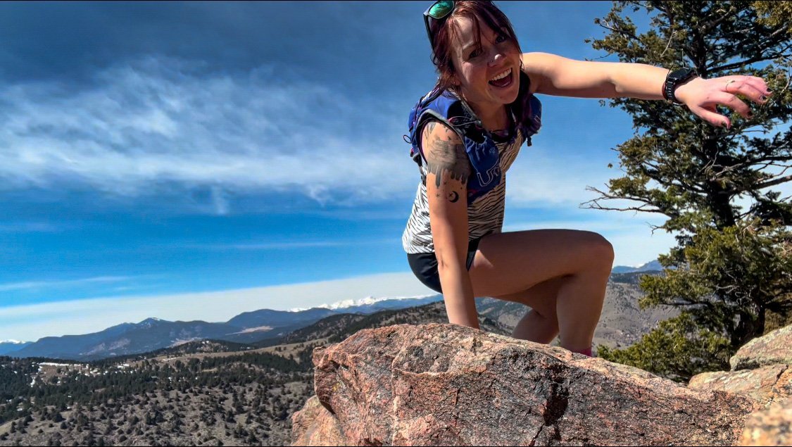
While Becca has loved hiking since she was a small child going on frequent trips to the Upper Peninsula of Michigan, she leaned more into hiking, camping, and backpacking by way of running. That is, road running led to trail running, which led to dreams of thru-hikes and FKTs.
Despite hip arthritis diagnosis forcing her to take a step back from competitive endurance sports and long hikes, she still spends as much time as possible hiking, trail running, and existing in the woods and mountains of Colorado. She credits her love for spending time in the woods to all the time she spent in the UP growing up.
In addition to her years as a competitive runner, she earned a USATF Level 1 certification for coaching distance running, and coached boys and girls high school cross country and track in Indianapolis for four years. Becca then joined the IUPUI women’s distance coaching staff as a volunteer assistant coach in 2020-2021.
She geeks out on trail running, track and field, and cries every time she watches a marathon (they’re just so beautiful!). After notching a few small FKTs under her belt in 2020, she was diagnosed with hip arthritis and now channels her passion for running into coaching, writing, creating training plans for her friends, hiking, and running when her hip allows it.
You can read more of Becca's work at her website or on her author page. You can follow her on Instagram at @beccad___ or her Substack.


